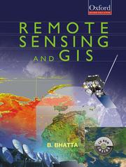
How long does it take to read Remote Sensing and GIS?
Basudeb Bhatta
Remote Sensing and GIS by Basudeb Bhatta takes about 13 hours 8 minutes to read at 250 words a minute.
About 13 hours 8 minutes
A week or two of reading
First published 2008. 716 pages, about 196,900 words.
27 days at 30 minutes a day
Estimate based on 275 words per page.
At other speeds
| Slow, 150 words a minute | 21 hours 53 minutes |
| Average, 250 words a minute | 13 hours 8 minutes |
| Fast, 400 words a minute | 8 hours 12 minutes |
The page count is the median across 3 editions, so your copy may differ. How we calculate.
About the book
Beginning with the history and basic concepts of remote sensing and GIS, the book gives an exhaustive coverage of optical, thermal and microwave remote sensing, global navigation satellite systems (such as GPS), digital photogrammetry, visual image analysis, digital image processing, spatial and attribute data model, geospatial analysis, and planning, implementation and management of GIS Remote Sensing and GIS is specifically designed to serve as a basic text for undergraduate courses in civil engineering, geoinformatics/geomatics engineering, geotechnical engineering, survey engineering, and environmental engineering. It will equally meet the requirements of undergraduate courses in geological science, environmental science, geography, geophysics, earth resources management, environmental management, and disaster management. The book provides a thorough understanding of the basic principles and techniques of remote sensing, geographic information systems (GIS), and their applications. It also presents the modern trends of remote sensing and GIS with an illustrated discussion on its numerous applications. The appendices provide the prerequisites required for understanding remote sensing and GIS technology. Owing to its lucid style and presentation of advanced topics, the book will also be useful to postgraduate students as well as practising professionals from the geomatics community.
Subjects: Remote sensing, Geographic information systems